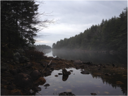
In 2014-15 Nova Scotia Power upgraded their early 20th century Indian River hydro-electric system and among many other improvements installed a $4m fish ladder on their Sandy Lake dam. Archaeologists jumped at the chance - a golden low water opportunity. There they found 6,000 year old aboriginal camp sites. Clearly, connecting the province's interior with St. Margaret's Bay and the ocean, the Indian River system has been a vital transportation corridor for millennia.
Not far from where this magical picture was taken, midst three small protected areas, is the historic Old Annapolis Trail built by Queen Victoria's own father to connect the new British garrison of Halifax with the old French capital, Port Royal near Annapolis. A couple of miles from the burgeoning Tantallon Crossroads where a half-million tourists pass annually on their way to Peggy's Cove, in the middle of a vibrant recreational node for hikers, kayakers, four-wheelers, hunters, fishers, nature lovers of all stripes, the lower Indian River with its mystical lakes and old forests - a magnet for the people of St. Margaret's Bay for generations and now for the thousands of newer residents in the growing communities along the Hammonds Plains Road. Here is where the Nova Scotia Department of Natural Resources in their wisdom, thumbing their noses at public opinion, have announced massive clearcuts. Clearly the Department is much better equipped to determine highest and best use than those who actually live here. Heavy logging they say, buzz 'er off, and this on the very doorsteps of those who might see a markedly different future unfold for these lands. Attached, a letter from the people of the Bay announcing their intent:
0 Comments
Your comment will be posted after it is approved.
Leave a Reply. |
Blog Archives
October 2020
Blog Index
All
|
Photo used under Creative Commons from DaveW99999


 RSS Feed
